Πώς να Προβλέψετε την Απόδοση Καλλιεργειών με Χρήση Τεχνητής Νοημοσύνης
Ανακαλύψτε πώς η τεχνητή νοημοσύνη μεταμορφώνει τη γεωργία με ακριβείς προβλέψεις απόδοσης καλλιεργειών χρησιμοποιώντας δορυφορικές εικόνες, αισθητήρες IoT, δεδομένα κλίματος και μοντέλα μηχανικής μάθησης. Μάθετε για τα καλύτερα παγκόσμια εργαλεία AI—NASA Harvest, Microsoft FarmBeats, EOSDA—που υποστηρίζουν αγρότες και αγροτικές επιχειρήσεις παγκοσμίως.
Η τεχνητή νοημοσύνη φέρνει επανάσταση στη γεωργία επιτρέποντας πολύ πιο ακριβείς προβλέψεις απόδοσης. Τα σημερινά μοντέλα AI μπορούν να επεξεργαστούν τεράστια σύνολα δεδομένων – πολύ περισσότερα από όσα μπορεί ένας άνθρωπος – για να προβλέψουν τις συγκομιδές.
Οι εφαρμογές AI έχουν σχεδιαστεί να επεξεργάζονται πολύ περισσότερα δεδομένα από έναν άνθρωπο και στη συνέχεια να αναλύουν αυτά τα δεδομένα για να κάνουν πιο ακριβείς προβλέψεις.
— Reuters
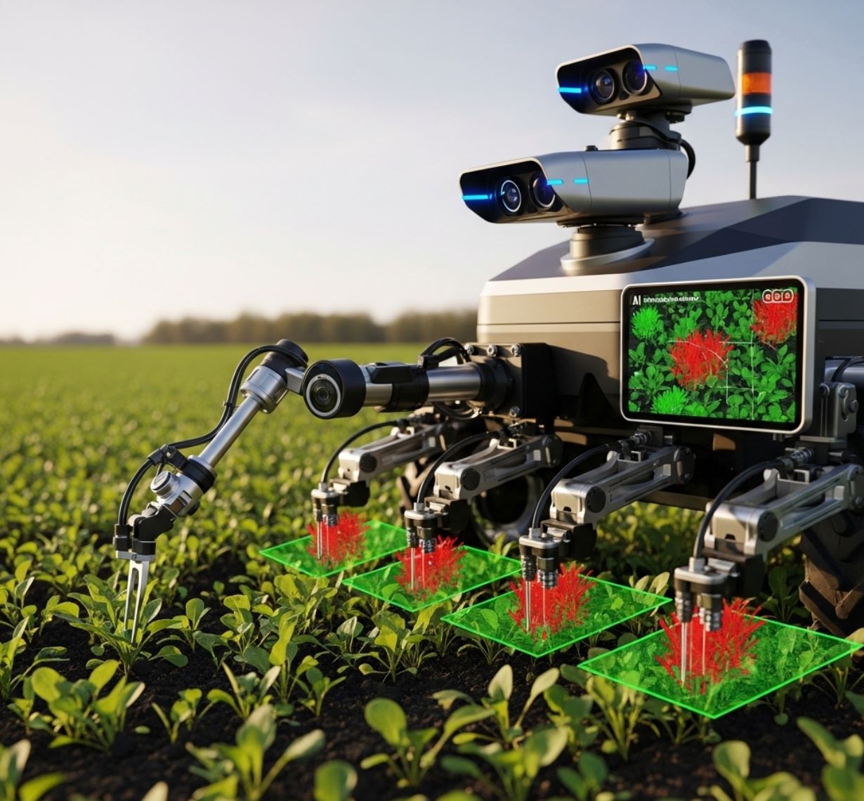
Οι ακριβείς προβλέψεις απόδοσης είναι ζωτικής σημασίας για την επισιτιστική ασφάλεια και τον σχεδιασμό, ειδικά καθώς η κλιματική αλλαγή απειλεί τις καλλιέργειες. Μελέτες αναφέρουν έως και 24% μείωση στην απόδοση καλαμποκιού έως το 2030 σε σενάρια υψηλής θέρμανσης. Τα σύγχρονα συστήματα AI παρακολουθούν συνεχώς τα χωράφια: μπορούν να εντοπίσουν στρες ή παράσιτα εβδομάδες νωρίτερα, να χαρτογραφήσουν προβληματικές περιοχές και ακόμη να προτείνουν πότε και πού να ποτίσουν ή να λιπάνουν.
Πηγές Δεδομένων για Μοντέλα AI Καλλιεργειών
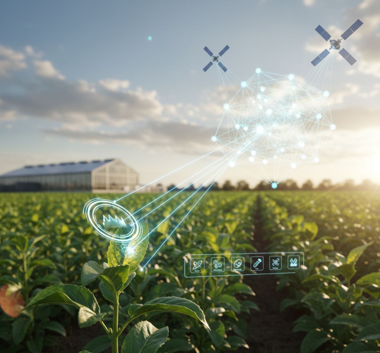
Τα μοντέλα απόδοσης καλλιεργειών AI βασίζονται σε πολλαπλές ροές δεδομένων για να δημιουργήσουν ολοκληρωμένη πληροφόρηση πεδίου:
Δορυφορικές & Αεροφωτογραφίες
Δεδομένα Καιρού & Κλίματος
Αισθητήρες Εδάφους & Υπογείων
Ιστορικά Αρχεία Απόδοσης

Μοντέλα Μηχανικής Μάθησης για Πρόβλεψη Απόδοσης
Μόλις συλλεχθούν τα δεδομένα, οι αλγόριθμοι μηχανικής μάθησης εκπαιδεύονται για να προβλέπουν αποδόσεις. Έχουν δοκιμαστεί πολλοί τύποι μοντέλων, ο καθένας με ξεχωριστά πλεονεκτήματα:
Σύνολα Βασισμένα σε Δέντρα
Οι μέθοδοι Random Forest και Gradient Boosting διαχειρίζονται εξαιρετικά καλά μικτά δεδομένα.
- Υπερέχουν σε πολλές μελέτες
- Διαχειρίζονται μη γραμμικές σχέσεις
- Είναι ανθεκτικά σε ακραίες τιμές
Νευρωνικά Δίκτυα
Τα ANN, τα συνελικτικά δίκτυα και τα επαναλαμβανόμενα LSTM ξεχωρίζουν με μεγάλα σύνολα δεδομένων.
- Αιχμαλωτίζουν σύνθετα μοτίβα
- Κλιμακώνονται με τον όγκο δεδομένων
- Επιτρέπουν μεταφορά μάθησης
Υβριδικές Προσεγγίσεις
Ο συνδυασμός βαθιάς μάθησης με μεταφορά μάθησης αυξάνει την ακρίβεια σε περιοχές με περιορισμένα δεδομένα.
- Αξιοποιούν προεκπαιδευμένα μοντέλα
- Προσαρμόζονται σε τοπικές συνθήκες
- Αξιοποιούν στο έπακρο περιορισμένα δεδομένα
Οι αλγόριθμοι μηχανικής μάθησης έχουν αποδειχθεί αποτελεσματικοί για την πρόβλεψη απόδοσης σε πολλές μελέτες.
— Έρευνα AI στη Γεωργία

Παγκόσμιες Εφαρμογές AI για Απόδοση Καλλιεργειών
Η πρόβλεψη απόδοσης με βάση την AI εφαρμόζεται πλέον παγκοσμίως σε όλες τις κύριες καλλιέργειες. Ακολουθούν βασικές πραγματικές εφαρμογές:
Κένυα – Πρόβλεψη Απόδοσης Καλαμποκιού
Ερευνητές συνδύασαν μοντέλο προσομοίωσης ανάπτυξης καλλιέργειας με τηλεπισκόπηση χρησιμοποιώντας δορυφορικά δεδομένα WaPOR του FAO για να προβλέψουν αποδόσεις καλαμποκιού. Η υβριδική προσέγγιση βελτίωσε την ακρίβεια σε σχέση με τη χρήση μόνο του μοντέλου, υποστηρίζοντας εκτιμήσεις απόδοσης σε περιοχές με περιορισμένα δεδομένα.
Ηνωμένες Πολιτείες – Χαρτογράφηση Παραγωγής Σιταριού
Ομάδες εκπαίδευσαν βαθιά δίκτυα LSTM σε πολυετή δεδομένα και δορυφορικούς δείκτες για να χαρτογραφήσουν την παραγωγή σιταριού ανά κομητεία, επιτρέποντας ακριβείς περιφερειακές προβλέψεις.
Ευρώπη – Παρακολούθηση Πολλαπλών Καλλιεργειών
Έργα όπως η πρωτοβουλία UPSCALE χρησιμοποιούν δεδομένα από drones και δορυφόρους για κριθάρι, σιτάρι, πατάτες και τριφύλλι για τον υπολογισμό δεικτών επιφάνειας φύλλων και χλωροφύλλης – κρίσιμες εισροές για τη βελτίωση των μοντέλων απόδοσης.

Εμπορικές Πλατφόρμες & Εργαλεία
Διάφορες πλατφόρμες AI ενσωματώνουν πλέον αυτές τις μεθόδους για πραγματικούς αγρότες παγκοσμίως:
SIMA (Αργεντινή)
Microsoft Azure FarmBeats
EOSDA Analytics
Υποστήριξη Πολλαπλών Καλλιεργειών
Εργαλεία και Πλατφόρμες που Υποστηρίζουν την Πρόβλεψη Απόδοσης
A growing ecosystem of AI tools supports yield forecasting. Notable examples include:
EOSDA Crop Monitoring
| Δημιουργός | EOS Data Analytics (EOSDA) |
| Υποστηριζόμενες Πλατφόρμες |
|
| Υποστήριξη Γλωσσών | Παγκόσμια κάλυψη με κύρια γλώσσα τα Αγγλικά· επιπλέον γλώσσες διαθέσιμες ανά περιοχή |
| Μοντέλο Τιμολόγησης | Πληρωμένη πλατφόρμα με επίπεδα συνδρομής (Essential, Professional, Enterprise) και προαιρετικά πρόσθετα όπως η εκτίμηση απόδοσης |
Επισκόπηση
Το EOSDA Crop Monitoring είναι μια πλατφόρμα ακριβείας γεωργίας που αξιοποιεί δορυφορικές εικόνες, δεδομένα καιρού και μηχανική μάθηση για την παρακολούθηση της υγείας των καλλιεργειών, την πρόβλεψη αποδόσεων και τη λήψη αποφάσεων βάσει δεδομένων. Σχεδιασμένο για αγρότες, γεωπόνους, συνεταιρισμούς και αγροτικές επιχειρήσεις, παρέχει απομακρυσμένη αξιολόγηση χωραφιού, σχεδιασμό πόρων και πρόβλεψη απόδοσης σε επίπεδο χωραφιού και περιφέρειας.
Πώς Λειτουργεί
Η πλατφόρμα χρησιμοποιεί δεδομένα τηλεπισκόπησης από δορυφόρους (Sentinel-2, PlanetScope και άλλους) σε συνδυασμό με προηγμένα μοντέλα τεχνητής νοημοσύνης για να παρέχει προβλεπτικές πληροφορίες. Το μοντέλο πρόβλεψης απόδοσης εφαρμόζει δύο συμπληρωματικές προσεγγίσεις:
- Στατιστικό Μοντέλο: Προβλέψεις βασισμένες σε μηχανική μάθηση εκπαιδευμένες σε ιστορικά δεδομένα απόδοσης και περιβάλλοντος
- Βιοφυσικό Μοντέλο: Πρόβλεψη καθοδηγούμενη από φαινολογία με χρήση αφομοίωσης δείκτη φυλλικής επιφάνειας
Τα δεδομένα ανανεώνονται κάθε 14 ημέρες για συνεχή βελτίωση των προβλέψεων, επιτυγχάνοντας ακρίβεια έως 95% υπό βέλτιστες συνθήκες. Αυτή η διπλή προσέγγιση υποστηρίζει τη λήψη αποφάσεων σε επίπεδο χωραφιού, την αξιολόγηση κινδύνου και τον μακροπρόθεσμο αγροτικό σχεδιασμό.
Κύρια Χαρακτηριστικά
Στατιστικές και βιοφυσικές προσεγγίσεις για ακριβή πρόβλεψη απόδοσης
Προβλέψεις απόδοσης έως 3 μήνες με κύκλους επαναβαθμονόμησης κάθε 14 ημέρες
Δείκτες μέσω δορυφόρου όπως NDVI, MSAVI, RECI, NDMI και άλλοι
Υπερτοπικές προβλέψεις 14 ημερών και ολοκληρωμένα ιστορικά δεδομένα καιρού
Χάρτες Εφαρμογής Μεταβλητής Δόσης που συνδυάζουν δορυφορικά και μηχανικά δεδομένα
Ημερολόγια δραστηριοτήτων χωραφιού, εργασίες επιθεώρησης και διαχείριση ομάδας πολλαπλών χρηστών
Πλήρης πρόσβαση API για ενσωμάτωση αγροτεχνολογίας και προσαρμοσμένες εφαρμογές
Εξαγωγή χαρτών σε μορφές TIFF, SHP και άλλες για εξωτερική ανάλυση
Πρόσβαση στην Πλατφόρμα
Ξεκινώντας
Εγγραφείτε στο EOSDA Crop Monitoring και επιλέξτε το επίπεδο συνδρομής σας (Essential, Professional ή Enterprise).
Σχεδιάστε τα όρια των χωραφιών απευθείας στον χάρτη ή ανεβάστε υπάρχοντα αρχεία ορίων για να ξεκινήσετε την παρακολούθηση.
Δείτε δείκτες βλάστησης, στρες νερού, ταξινόμηση καλλιέργειας και στάδια ανάπτυξης βάσει φαινολογικών κλιμάκων BBCH για να σχεδιάσετε εργασίες στο χωράφι.
Ενεργοποιήστε το πρόσθετο πρόβλεψης απόδοσης και παρέχετε ημερομηνίες σποράς, ποικιλίες καλλιέργειας και ιστορικά δεδομένα απόδοσης για βαθμονόμηση των μοντέλων και ακριβείς προβλέψεις.
Εξάγετε χάρτες σε μορφές TIFF ή SHP, δημιουργήστε χάρτες ζωνών VRA ή ενσωματώστε με τα συστήματά σας μέσω του API για προγραμματιστές.
Τεχνικές Προδιαγραφές
| Υποστηριζόμενες Καλλιέργειες | Πάνω από 100 τύπους καλλιεργειών στο μοντέλο πρόβλεψης απόδοσης |
| Ακρίβεια Πρόβλεψης | Έως ~95% υπό βέλτιστες συνθήκες δεδομένων |
| Ορίζοντας Πρόβλεψης | Έως 3 μήνες μπροστά |
| Συχνότητα Ενημέρωσης Δεδομένων | Κάθε 14 ημέρες για επαναβαθμονόμηση μοντέλου |
| Πηγές Δορυφορικών Δεδομένων | Sentinel-2 (ανάλυση 10 μ.), PlanetScope (ανάλυση 3 μ.) και άλλοι |
| Δείκτες Βλάστησης | NDVI, MSAVI, RECI, NDMI και επιπλέον δείκτες |
| Πρόβλεψη Καιρού | Υπερτοπικές προβλέψεις 14 ημερών με ιστορικές αναλύσεις |
| Μορφές Εξαγωγής | TIFF, SHP και άλλες τυπικές μορφές GIS |
| Πρόσβαση API | Διαθέσιμη για δορυφορικές εικόνες, δείκτες βλάστησης, δεδομένα καιρού και ζωνοποίηση χωραφιού |
| Υποδομή | Πλατφόρμα βασισμένη στο cloud που απαιτεί σύνδεση στο διαδίκτυο |
Σημαντικές Παρατηρήσεις
- Η ακρίβεια εξαρτάται από την ποιότητα των δεδομένων, συμπεριλαμβανομένων ιστορικών αρχείων απόδοσης, δεδομένων εδάφους και φαινολογικών εισροών
- Ο ορίζοντας πρόβλεψης περιορίζεται περίπου σε 3 μήνες, καθιστώντας το λιγότερο κατάλληλο για πολύ μακροπρόθεσμες προβλέψεις
- Απαιτεί σύνδεση στο διαδίκτυο· η λειτουργία εκτός σύνδεσης είναι περιορισμένη λόγω της αρχιτεκτονικής cloud
- Η βαθμονόμηση του βιοφυσικού μοντέλου απαιτεί εισαγωγή από τον χρήστη ημερομηνιών σποράς, ποικιλιών καλλιέργειας και άλλων φαινολογικών παραμέτρων
- Δεν είναι κατάλληλο για αγροτικές εργασίες εκτός σύνδεσης ή αποσυνδεδεμένες
Συχνές Ερωτήσεις
Το EOSDA Crop Monitoring υποστηρίζει πρόβλεψη απόδοσης για πάνω από 100 τύπους καλλιεργειών, καλύπτοντας τις περισσότερες σημαντικές αγροτικές εμπορεύσιμες και περιφερειακές καλλιέργειες.
Η ακρίβεια της πρόβλεψης μπορεί να φτάσει έως περίπου 95% υπό βέλτιστες συνθήκες, ανάλογα με την ποιότητα των δεδομένων, τα ιστορικά αρχεία απόδοσης και τη σωστή βαθμονόμηση του μοντέλου.
Οι είσοδοι του μοντέλου ενημερώνονται κάθε 14 ημέρες, επιτρέποντας συνεχή επαναβαθμονόμηση και βελτίωση των προβλέψεων απόδοσης καθ’ όλη τη διάρκεια της καλλιεργητικής περιόδου.
Ναι. Το EOSDA παρέχει πλήρες API που επιτρέπει ενσωμάτωση με προσαρμοσμένες εφαρμογές και πλατφόρμες αγροτεχνολογίας, προσφέροντας πρόσβαση σε δορυφορικές εικόνες, δείκτες βλάστησης, δεδομένα καιρού, ζωνοποίηση χωραφιού και άλλα.
Για το στατιστικό μοντέλο, τα ιστορικά δεδομένα απόδοσης βελτιώνουν την ακρίβεια αλλά δεν είναι πάντα απαραίτητα. Για το βιοφυσικό μοντέλο, πρέπει να παρέχετε ποικιλία καλλιέργειας, ημερομηνίες σποράς και άλλες φαινολογικές εισροές για μέγιστη ακρίβεια πρόβλεψης.
Taranis Ag Intelligence
| Δημιουργός | Taranis Inc. |
| Πλατφόρμα | Πλατφόρμα βασισμένη στο web με συλλογή αεροφωτογραφιών μέσω drone, αεροπλάνου και δορυφόρου |
| Παγκόσμια Κάλυψη | Λειτουργεί παγκοσμίως με πελάτες στις Ηνωμένες Πολιτείες, την Ευρώπη, τη Βραζιλία και πέραν αυτών |
| Μοντέλο Τιμολόγησης | Υπηρεσία με συνδρομή επί πληρωμή· δεν υπάρχει δημόσιο δωρεάν πλάνο |
Επισκόπηση
Η πλατφόρμα Taranis Ag Intelligence συνδυάζει αεροφωτογραφίες υπερυψηλής ανάλυσης με γεννητική τεχνητή νοημοσύνη για να παρέχει ανάλυση καλλιεργειών σε επίπεδο φύλλου. Το σύστημα ανιχνεύει πρώιμα σημάδια παρασίτων, ασθενειών, ελλείψεων θρεπτικών συστατικών και πίεσης από ζιζάνια, επιτρέποντας στους παραγωγούς και γεωπόνους να αντιδρούν προληπτικά. Με την ενσωμάτωση του γεννητικού κινητήρα AI Ag Assistant με πλούσια δεδομένα εικόνων, η Taranis υποστηρίζει την πρόβλεψη απόδοσης και τη λήψη αποφάσεων βάσει δεδομένων για βελτιστοποιημένη χρήση εισροών και αυξημένη παραγωγικότητα.
Πώς Λειτουργεί
Η Taranis χρησιμοποιεί στόλο χαμηλά πετώντων αεροσκαφών (drones και αεροπλάνα) για τη λήψη εικόνων με υπο-χιλιοστομετρική ανάλυση — περίπου 0,3 mm ανά pixel — σε αγροτεμάχια. Η πλατφόρμα AI αναλύει εκατοντάδες εκατομμύρια δεδομένα για να αναγνωρίσει παράγοντες καταπόνησης των καλλιεργειών, όπως έντομα, ασθένειες, ζιζάνια και θρεπτικά προβλήματα. Ο γεννητικός κινητήρας AI Ag Assistant συνδυάζει αυτά τα δεδομένα σε επίπεδο φύλλου με καιρικά πρότυπα, γεωπονική έρευνα και πληροφορίες προστασίας καλλιεργειών για να παράγει ακριβείς, ειδικές για το χωράφι αναλύσεις και συστάσεις. Πρόσφατες βελτιώσεις περιλαμβάνουν προηγμένους αλγορίθμους πρόβλεψης απόδοσης που προβλέπουν την μελλοντική απόδοση βάσει των ανιχνευμένων κινδύνων υγείας του χωραφιού.
Κύρια Χαρακτηριστικά
Ανάλυση σε επίπεδο φύλλου από λήψεις drone και αεροπλάνου με ανάλυση 0,3 mm ανά pixel
Αυτόματη αναγνώριση παρασίτων, ασθενειών, ελλείψεων θρεπτικών, πίεσης ζιζανίων και καταμέτρησης φυτών
Γεννητική τεχνητή νοημοσύνη που παρέχει εξατομικευμένες γεωπονικές συστάσεις και αναφορές επιθεώρησης
Προηγμένοι αλγόριθμοι που προβλέπουν την απόδοση καλλιέργειας βάσει των δεδομένων AI σε επίπεδο φύλλου
Συλλογή δεδομένων και πλήρης παρακολούθηση όλο το χρόνο για μεγάλες επιχειρήσεις
Πρόσβαση στην Taranis
Ξεκινώντας
Εγγραφείτε στην Taranis μέσω της ιστοσελίδας τους και επιλέξτε το κατάλληλο πλάνο υπηρεσίας για τη λειτουργία σας.
Παρέχετε χάρτες χωραφιών ή συντονιστείτε με την Taranis για τον προγραμματισμό της συλλογής αεροφωτογραφιών.
Η Taranis πετάει πάνω από τα χωράφια σας σε προγραμματισμένα διαστήματα χρησιμοποιώντας drones ή αεροπλάνα για τη λήψη εικόνων υψηλής ανάλυσης.
Οι εικόνες επεξεργάζονται με αλγορίθμους AI για την ανίχνευση απειλών και τη δημιουργία χρήσιμων αναλύσεων.
Πρόσβαση σε παραγόμενες γεωπονικές αναφορές μέσω του Ag Assistant, συμπεριλαμβανομένων συστάσεων και προβλέψεων απόδοσης.
Ενσωματώστε τις αναλύσεις στη διαχείριση της φάρμας, συμπεριλαμβανομένης της εφαρμογής εισροών, προγραμμάτων επιθεώρησης και στρατηγικών προστασίας καλλιεργειών.
Σημαντικές Παρατηρήσεις
- Απαιτούνται φυσικές πτήσεις (drones ή αεροπλάνα), που μπορεί να περιορίσουν την πρόσβαση σε ορισμένες περιοχές ή να αυξήσουν το κόστος λειτουργίας
- Διαχειρίζεται μεγάλα όγκους δεδομένων· η υπο-χιλιοστομετρική απεικόνιση απαιτεί ισχυρή υποδομή και τεχνική εξειδίκευση
- Η προστασία και το απόρρητο των δεδομένων πρέπει να διαχειρίζονται προσεκτικά λόγω των εικόνων υψηλής ανάλυσης
- Βελτιστοποιημένη για συμβούλους, λιανοπωλητές γεωπονικών και μεγάλες επιχειρήσεις· οι μικρότερες φάρμες μπορεί να έχουν περιορισμένη άμεση πρόσβαση
- Οι προβλέψεις απόδοσης βασίζονται σε AI και μπορεί να διαφέρουν ανάλογα με την ποιότητα των εικόνων και των δεδομένων εισόδου
- Ορισμένες συστάσεις που παράγονται από την AI μπορεί να απαιτούν χειροκίνητη επανεξέταση από γεωπόνους πριν την εφαρμογή
- Η σταθερή αεροφωτογράφιση μπορεί να μην είναι εφικτή σε όλες τις περιοχές ή υπό όλες τις καιρικές συνθήκες
Συχνές Ερωτήσεις
Η Taranis χρησιμοποιεί αλγορίθμους πρόβλεψης απόδοσης με τεχνητή νοημοσύνη ενσωματωμένους στο Ag Assistant, συνδυάζοντας δεδομένα απεικόνισης σε επίπεδο φύλλου με γεωπονικές πληροφορίες, καιρικά πρότυπα και δείκτες καταπόνησης του χωραφιού για να προβλέψει τη μελλοντική απόδοση της καλλιέργειας.
Οι αεροφωτογραφίες της Taranis επιτυγχάνουν ανάλυση περίπου 0,3 mm ανά pixel, επιτρέποντας εξαιρετικά λεπτομερή ανάλυση σε επίπεδο φύλλου και πρώιμη ανίχνευση παραγόντων καταπόνησης.
Η πλατφόρμα είναι βελτιστοποιημένη για συμβούλους, λιανοπωλητές γεωπονικών και μεγάλες επιχειρήσεις. Ενώ οι μικρότερες φάρμες μπορεί να έχουν πρόσβαση στην Taranis μέσω συνεργασιών ή συνεταιριστικών συμφωνιών, η άμεση πρόσβαση εξαρτάται από το πλάνο υπηρεσίας και το μέγεθος της λειτουργίας.
Ο Ag Assistant είναι ένας γεννητικός κινητήρας τεχνητής νοημοσύνης που επεξεργάζεται εικόνες χωραφιού, γεωπονικά δεδομένα, ερευνητικά ευρήματα και πληροφορίες καιρού για να παράγει εξατομικευμένες γεωπονικές αναφορές και ειδικές για το χωράφι συστάσεις.
Ναι. Αναλύοντας εικόνες υψηλής ανάλυσης σε επίπεδο φύλλου, η Taranis ανιχνεύει πρώιμα σημάδια προσβολής από παράσιτα, ασθένειες, ελλείψεις θρεπτικών και πίεση από ζιζάνια, επιτρέποντας προληπτικές παρεμβάσεις πριν προκληθεί σημαντική ζημιά στην καλλιέργεια.
Climate FieldView (Bayer)
| Προγραμματιστής | Bayer (The Climate Corporation) |
| Υποστηριζόμενες Πλατφόρμες |
|
| Διαθεσιμότητα | Πάνω από 20 χώρες, συμπεριλαμβανομένων ΗΠΑ, Βραζιλίας, Καναδά, Ευρώπης, Νότιας Αφρικής, Αυστραλίας και Τουρκίας |
| Μοντέλο Τιμολόγησης | Βασικό (δωρεάν) με περιορισμένες λειτουργίες· τα επί πληρωμή επίπεδα περιλαμβάνουν Prime, Plus και Premium για προηγμένη ανάλυση |
Επισκόπηση
Το Climate FieldView της Bayer είναι μια ψηφιακή πλατφόρμα γεωργίας με τεχνητή νοημοσύνη που ενοποιεί αγρονομικά, μηχανικά, μετεωρολογικά και δορυφορικά δεδομένα σε ένα έξυπνο σύστημα. Επεξεργαζόμενο δισεκατομμύρια σημεία δεδομένων και πάνω από 250 στρώματα υψηλής ανάλυσης, βοηθά τους αγρότες να αποκτήσουν πρακτικές πληροφορίες για το χωράφι, να προβλέψουν την απόδοση της καλλιέργειας, να βελτιστοποιήσουν τα μέσα και να λαμβάνουν αποφάσεις βασισμένες σε δεδομένα για μέγιστη απόδοση επένδυσης.
Πώς Λειτουργεί
Το Climate FieldView συγκεντρώνει δεδομένα από τρακτέρ, σπαρτικές, θεριζοαλωνιστικές, αισθητήρες, μετεωρολογικούς σταθμούς και δορυφορικές εικόνες σε μια κεντρική πλατφόρμα στο cloud. Τα μοντέλα μηχανικής μάθησης αναλύουν αυτά τα πολυεπίπεδα δεδομένα για να δημιουργήσουν προβλέψεις αποδόσεων, να αξιολογήσουν την υγεία των καλλιεργειών και να παρέχουν αγρονομικές συστάσεις. Με ενσωμάτωση σε εξωτερικά συστήματα μέσω APIs (όπως CLAAS Telematics) και συγχρονισμό δεδομένων μηχανημάτων μέσω FieldView Drive, η πλατφόρμα προσφέρει ολοκληρωμένη ορατότητα της εκμετάλλευσης και προβλεπτικές πληροφορίες για αποφάσεις σποράς, προστασίας καλλιεργειών και συγκομιδής.
Κύρια Χαρακτηριστικά
Τα μοντέλα μηχανικής μάθησης χρησιμοποιούν ιστορικά δεδομένα, καιρικά μοτίβα και δορυφορικές εικόνες για να προβλέψουν με ακρίβεια την απόδοση της καλλιέργειας.
Οι δορυφορικοί χάρτες δείχνουν το στρες των καλλιεργειών, τη βιομάζα και τις συνθήκες του χωραφιού σε σχεδόν πραγματικό χρόνο για έγκαιρη παρέμβαση.
Συνδέεται με τρακτέρ, θεριζοαλωνιστικές και εξοπλισμό για αυτόματο συγχρονισμό αγρονομικών και δεδομένων αποδόσεων.
Επιθεωρήστε χωράφια, δημιουργήστε αναφορές ανάλυσης αποδόσεων μετά τη συγκομιδή και εξάγετε δεδομένα σε μορφές PDF ή CSV.
Υποστηρίζει ενσωματώσεις τρίτων (CLAAS API, Combyne) και συνδέεται με πλατφόρμες διαχείρισης σιτηρών.
Πρόσβαση σε δεδομένα χωραφιού και πληροφορίες από οποιαδήποτε συσκευή μέσω της πλατφόρμας web ή της εφαρμογής για iOS.
Λήψη ή Πρόσβαση
Ξεκινώντας
Δημιουργήστε λογαριασμό στην ιστοσελίδα του Climate FieldView και επιλέξτε είτε το δωρεάν βασικό πλάνο είτε ένα επί πληρωμή επίπεδο (Prime, Plus, Premium) ανάλογα με τις ανάγκες σας.
Τοποθετήστε το υλικό FieldView Drive στη θύρα διαγνωστικού της μηχανής σας για να ξεκινήσετε τη ροή δεδομένων μηχανής στον λογαριασμό σας.
Εισάγετε ιστορικά δεδομένα μέσω του Data Inbox ή συγχρονίστε αυτόματα μέσω συνδεδεμένων μηχανημάτων, APIs ή μετεωρολογικών σταθμών.
Χρησιμοποιήστε την πλατφόρμα web ή την εφαρμογή για κινητά για να δείτε δορυφορικούς χάρτες, να εντοπίσετε ζώνες στρες και να παρακολουθείτε τις συνθήκες των καλλιεργειών καθ’ όλη τη διάρκεια της σεζόν.
Μετά τη συγκομιδή, χρησιμοποιήστε τα εργαλεία Ανάλυσης Αποδόσεων και Αναφορών Περιοχής Χωραφιού για να αξιολογήσετε την απόδοση και να λάβετε προβλέψεις με τεχνητή νοημοσύνη για την επόμενη σεζόν.
Εξάγετε ολοκληρωμένες αναφορές σε μορφές PDF ή CSV για να τις μοιραστείτε με αγρονόμους, συμβούλους ή επιχειρηματικούς συνεργάτες.
Σημαντικές Παρατηρήσεις
- Η πλήρης αξιοποίηση της πλατφόρμας συνήθως απαιτεί συμβατό υλικό (FieldView Drive) και σύνδεση μηχανημάτων
- Η ακρίβεια πρόβλεψης αποδόσεων εξαρτάται από την ποιότητα και πληρότητα των δεδομένων εισόδου (δεδομένα μηχανών, δορυφορικές εικόνες, καιρός)
- Ορισμένες προηγμένες ενσωματώσεις και λειτουργίες μπορεί να μην είναι διαθέσιμες σε όλες τις περιοχές
- Η διαχείριση και ερμηνεία μεγάλου όγκου δεδομένων απαιτεί ψηφιακές δεξιότητες και επένδυση χρόνου από τους αγρότες
Συχνές Ερωτήσεις
Το Climate FieldView χρησιμοποιεί προηγμένους αλγόριθμους μηχανικής μάθησης για να αναλύσει ιστορικά δεδομένα χωραφιού, πραγματικά καιρικά μοτίβα, δορυφορικές εικόνες και αγρονομικά δεδομένα που παράγονται από μηχανήματα. Αυτή η πολυεπίπεδη ανάλυση παράγει ακριβείς προβλέψεις αποδόσεων για να σας βοηθήσει να σχεδιάσετε και να βελτιστοποιήσετε τις γεωργικές σας εργασίες.
Ναι, το Βασικό πλάνο είναι εντελώς δωρεάν και περιλαμβάνει βασικές λειτουργίες όπως αποθήκευση δεδομένων, οπτικοποίηση χωραφιού και δυνατότητες μεταφόρτωσης δεδομένων. Τα επί πληρωμή επίπεδα (Prime, Plus, Premium) ξεκλειδώνουν προηγμένες αναλύσεις, μοντελοποίηση προβλέψεων και υποστήριξη premium.
Απολύτως. Μπορείτε να συνδέσετε τον εξοπλισμό σας χρησιμοποιώντας το υλικό FieldView Drive ή μέσω ενσωματώσεων API (όπως το CLAAS Telematics). Αυτό επιτρέπει τον αυτόματο συγχρονισμό δεδομένων εργασιών χωραφιού, πληροφοριών αποδόσεων και διαγνωστικών μηχανών απευθείας στον λογαριασμό σας στο FieldView.
Το Climate FieldView είναι διαθέσιμο σε πάνω από 20 χώρες παγκοσμίως, συμπεριλαμβανομένων των Ηνωμένων Πολιτειών, Βραζιλίας, Καναδά, ευρωπαϊκών χωρών, Νότιας Αφρικής, Αυστραλίας και Τουρκίας. Η διαθεσιμότητα και τα χαρακτηριστικά μπορεί να διαφέρουν ανά περιοχή.
Μετά τη συγκομιδή, χρησιμοποιήστε τις λειτουργίες Αναφορών Περιοχής Χωραφιού και Ανάλυσης Αποδόσεων για να εξετάσετε τα δεδομένα απόδοσης του χωραφιού. Μπορείτε να εξάγετε λεπτομερείς αναφορές που δείχνουν τη διανομή αποδόσεων, την ανάλυση επιπτώσεων των εισροών και συστάσεις που παράγονται από τεχνητή νοημοσύνη για τη βελτιστοποίηση της στρατηγικής της επόμενης σεζόν.
AGRIVISION AI
| Προγραμματιστής | AgriVision AI Tech (Nutriyo Agro Foods Pvt Ltd) |
| Υποστηριζόμενες Πλατφόρμες |
|
| Υποστήριξη Γλωσσών | Πολλές περιφερειακές γλώσσες με φωνητική υποστήριξη· βελτιστοποιημένη για Ινδούς αγρότες |
| Μοντέλο Τιμολόγησης | Freemium / επί πληρωμή· οι βασικές λειτουργίες συμβουλών και παρακολούθησης περιλαμβάνονται στην εμπορική προσφορά |
Επισκόπηση
Η AgriVision AI είναι μια έξυπνη αγροτεχνολογική πλατφόρμα που αξιοποιεί την τεχνητή νοημοσύνη, την υπολογιστική όραση και την τεχνολογία φωνής για να παρέχει πληροφορίες καλλιεργειών σε πραγματικό χρόνο, προβλέψεις απόδοσης και συμβουλές για παράσιτα/ασθένειες. Σχεδιασμένη ειδικά για αγρότες και οργανώσεις παραγωγών αγροτών (FPOs), συνδυάζει τη διάγνωση μέσω εικόνων με περιβαλλοντικά δεδομένα και προβλεπτική ανάλυση για να βελτιώσει την παραγωγικότητα και να υποστηρίξει καλύτερες γεωργικές αποφάσεις.
Πώς Λειτουργεί
Η AgriVision AI διευκολύνει την πρόσβαση σε αγρονομική νοημοσύνη με τεχνητή νοημοσύνη μέσω μιας απλής κινητής διεπαφής. Οι αγρότες τραβούν φωτογραφίες των καλλιεργειών τους, τις οποίες αναλύουν μοντέλα μηχανικής μάθησης για να ανιχνεύσουν ασθένειες, παράσιτα και ελλείψεις θρεπτικών. Αυτές οι πληροφορίες ενισχύονται με προβλεπτικά μοντέλα απόδοσης που τροφοδοτούνται από αισθητήρες IoT, περιβαλλοντική παρακολούθηση και δεδομένα από τους αγρότες. Η πλατφόρμα διαθέτει φωνητικές συμβουλές στις τοπικές γλώσσες, καθιστώντας την προσβάσιμη σε αγρότες με περιορισμένη γραμματισμό. Οι FPOs και οι συνεταιρισμοί έχουν πρόσβαση σε πίνακες ελέγχου για την παρακολούθηση συνολικής απόδοσης και υγείας καλλιεργειών.

Κύρια Χαρακτηριστικά
Ανιχνεύει ασθένειες, παράσιτα και θρεπτικό στρες χρησιμοποιώντας εικόνες από κάμερα κινητού για ακριβή αξιολόγηση της υγείας των καλλιεργειών.
Χρησιμοποιεί προηγμένα μοντέλα AI για να προβλέψει την απόδοση της καλλιέργειας βάσει περιβαλλοντικών δεδομένων, εικόνων και εισροών από αγρότες.
Αποστέλλει άμεσες ειδοποιήσεις για ενημερώσεις καιρού, έξαρση παρασίτων και κινδύνους ασθενειών για να κρατά τους αγρότες ενήμερους.
Παρέχει καθοδήγηση σε πολλές περιφερειακές γλώσσες με φωνητική εισαγωγή και έξοδο, ακόμα και σε offline λειτουργία.
Συγκεντρωτικές πληροφορίες και εργαλεία υποστήριξης αποφάσεων για οργανώσεις παραγωγών αγροτών και συνεταιρισμούς.
Λειτουργεί χωρίς σύνδεση στο διαδίκτυο· συγχρονίζει δεδομένα όταν αποκαθίσταται η σύνδεση για απρόσκοπτη πρόσβαση.
Λήψη ή Πρόσβαση
Ξεκινώντας
Εγγραφείτε στην AgriVision AI μέσω της ιστοσελίδας ή της εφαρμογής για κινητά χρησιμοποιώντας τον αριθμό τηλεφώνου ή το email σας.
Καταχωρίστε τις πληροφορίες του αγροτεμαχίου σας, τον τύπο καλλιέργειας και τις ημερομηνίες σποράς για να δημιουργήσετε το προφίλ σας.
Χρησιμοποιήστε την κάμερα του κινητού σας για να φωτογραφίσετε τα φύλλα των φυτών και ανεβάστε τις εικόνες στην εφαρμογή για ανάλυση με AI.
Λάβετε εξατομικευμένες προτάσεις για παράσιτα, ασθένειες και θρεπτικά στοιχεία μέσω κειμένου ή φωνής στη γλώσσα σας.
Μείνετε ενημερωμένοι με ειδοποιήσεις καιρού και κινδύνων παρασίτων/ασθενειών μέσω του συστήματος ειδοποιήσεων της εφαρμογής.
Χρησιμοποιήστε τη λειτουργία πρόβλεψης απόδοσης για να εκτιμήσετε την μελλοντική παραγωγή και να προγραμματίσετε ανάλογα.
Οι οργανώσεις παραγωγών αγροτών μπορούν να έχουν πρόσβαση στον πίνακα ελέγχου web για να δουν συγκεντρωτικά δεδομένα και συλλογικές πληροφορίες.
Σημαντικές Παρατηρήσεις
Συχνές Ερωτήσεις
Η AgriVision AI χρησιμοποιεί προηγμένα μοντέλα μηχανικής μάθησης που συνδυάζουν ανάλυση εικόνων των καλλιεργειών σας, δεδομένα αισθητήρων περιβάλλοντος (καιρός, συνθήκες εδάφους) και εισροές από αγρότες για να παράγει ακριβείς προβλέψεις απόδοσης.
Ναι, η AgriVision AI υποστηρίζει λειτουργία offline. Μπορείτε να χρησιμοποιήσετε βασικές λειτουργίες χωρίς σύνδεση· ωστόσο, οι ενημερώσεις συμβουλών και ο συγχρονισμός δεδομένων απαιτούν περιοδική σύνδεση.
Η πλατφόρμα υποστηρίζει φωνητική εισαγωγή και καθοδήγηση σε πολλές περιφερειακές γλώσσες, καθιστώντας την προσβάσιμη σε αγρότες από διάφορες γλωσσικές περιοχές της Ινδίας.
Απολύτως. Η AgriVision AI έχει σχεδιαστεί ειδικά για μικρούς αγρότες και FPOs, με απλή κινητή διεπαφή, υποστήριξη τοπικών γλωσσών και προσιτές επιλογές τιμολόγησης.
Ναι, η εφαρμογή στέλνει ειδοποιήσεις σε πραγματικό χρόνο για κινδύνους παρασίτων, έξαρση ασθενειών και δυσμενείς καιρικές συνθήκες, βοηθώντας σας να λάβετε γρήγορα προληπτικά μέτρα.
CropX
| Προγραμματιστής | CropX Technologies, Inc. |
| Υποστηριζόμενες Πλατφόρμες |
|
| Παγκόσμια Διαθεσιμότητα | Ενεργό σε πάνω από 70 χώρες παγκοσμίως |
| Μοντέλο Τιμολόγησης | Επί πληρωμή συνδρομή — απαιτεί επένδυση σε εξοπλισμό (αισθητήρες) και συνεχή τέλη πλατφόρμας |
Επισκόπηση
Το CropX είναι μια πλατφόρμα γεωργίας ακριβείας με τεχνητή νοημοσύνη που συνδυάζει δεδομένα αισθητήρων εδάφους, μηχανική μάθηση, πληροφορίες καιρού και δορυφορικές εικόνες για τη βελτιστοποίηση της άρδευσης, της εφαρμογής λιπασμάτων και της διαχείρισης καλλιεργειών. Ενσωματώνοντας δεδομένα πεδίου σε πραγματικό χρόνο με προβλεπτική ανάλυση, το CropX βοηθά τους αγρότες να μεγιστοποιήσουν τις αποδόσεις, να μειώσουν τη σπατάλη εισροών και να βελτιώσουν την αποδοτικότητα των πόρων σε μεγάλη κλίμακα.
Πώς Λειτουργεί
Το CropX εγκαθιστά ένα δίκτυο αισθητήρων εδάφους που μετρούν συνεχώς την υγρασία, τη θερμοκρασία και την ηλεκτρική αγωγιμότητα σε πολλαπλά βάθη. Αυτά τα δεδομένα σε πραγματικό χρόνο τροφοδοτούν την πλατφόρμα cloud του CropX, όπου αλγόριθμοι τεχνητής νοημοσύνης τα συνδυάζουν με τοπικά καιρικά μοτίβα, τοπογραφία, δορυφορικές εικόνες και δεδομένα γεωργικών μηχανημάτων για να παράγουν πρακτικές αγρονομικές πληροφορίες. Το σύστημα χρησιμοποιεί επικυρωμένα μοντέλα καλλιεργειών για να προβλέψει το στρες των φυτών, τον κίνδυνο ασθενειών και να υπολογίσει την αποδοτικότητα χρήσης νερού.
Μια τεκμηριωμένη δοκιμή πεδίου απέδειξε αύξηση απόδοσης 22% με άρδευση που καθοδηγείται από το CropX, αποτρέποντας το στρες από έλλειψη νερού και ταιριάζοντας με ακρίβεια τις ανάγκες νερού του εδάφους.
Κύρια Χαρακτηριστικά
Οι αισθητήρες στο χωράφι παρακολουθούν υγρασία, θερμοκρασία και ηλεκτρική αγωγιμότητα σε πολλαπλά βάθη για συνεχή πληροφόρηση πεδίου.
Μοντέλα μηχανικής μάθησης ενσωματώνουν δεδομένα εδάφους, καιρού, δορυφόρου και μηχανημάτων για καθοδήγηση αποφάσεων άρδευσης και λίπανσης.
Δημιουργία χαρτών συνταγών για σπορά, λίπανση και άρδευση προσαρμοσμένων στην ποικιλότητα του χωραφιού και τις συνθήκες εδάφους.
Βελτιστοποίηση σεναρίων άρδευσης βάσει ζωνών υγρασίας εδάφους για μέγιστη αποδοτικότητα νερού και απόδοση καλλιέργειας.
Εισαγωγή δεδομένων γεωργικών μηχανημάτων μέσω μορφών ISO-XML, CSV, SHP και TIFF για ολοκληρωμένη ανάλυση πεδίου.
Παρακολούθηση εξοικονόμησης νερού, διαρροής αζώτου και χρήσης εισροών για υποστήριξη αποδοτικών και βιώσιμων γεωργικών πρακτικών.
Λήψη ή Πρόσβαση
Ξεκινώντας
Τοποθετήστε τους αισθητήρες CropX στο χωράφι σας σε καθορισμένα βάθη (συνήθως 20 εκ. και 46 εκ.) για να ξεκινήσετε τη συλλογή δεδομένων εδάφους σε πραγματικό χρόνο.
Ρυθμίστε τη μετάδοση δεδομένων μέσω 4G, Bluetooth ή δορυφορικής σύνδεσης για συνεχή ροή δεδομένων αισθητήρων στην πλατφόρμα cloud.
Χρησιμοποιήστε την εφαρμογή CropX ή τον πίνακα ελέγχου web για να ορίσετε τα όρια των χωραφιών και να συνδέσετε επιπλέον πηγές δεδομένων όπως μετεωρολογικούς σταθμούς και χάρτες τοπογραφίας.
Ανεβάστε χάρτες απόδοσης, αρχεία μηχανημάτων και συνταγές σε μορφές ISO-XML, CSV, SHP ή TIFF για ολοκληρωμένη ανάλυση πεδίου.
Χρησιμοποιήστε το εργαλείο VRA για να δημιουργήσετε χάρτες εφαρμογής μεταβλητών ποσοτήτων για σπορά, λίπανση και άρδευση προσαρμοσμένους στις ειδικές συνθήκες του χωραφιού σας.
Εξάγετε σενάρια VRI στον ελεγκτή άρδευσης ή το σύστημα περιστροφής σας, ή προσαρμόστε χειροκίνητα τις λειτουργίες βάσει των συστάσεων του CropX.
Παρακολουθήστε δεδομένα αισθητήρων σε πραγματικό χρόνο, δείκτες βλάστησης από δορυφόρο και προειδοποιήσεις κινδύνου ασθενειών στον διαισθητικό πίνακα ελέγχου.
Μετά τη συγκομιδή, αναλύστε δεδομένα απόδοσης και αναφορές πεδίου για να αξιολογήσετε την αποτελεσματικότητα των συνταγών και να βελτιώσετε τις στρατηγικές για τις μελλοντικές περιόδους.
Σημαντικές Παρατηρήσεις
- Απαιτούνται επαναλαμβανόμενα τέλη συνδρομής για πλήρη πρόσβαση σε αναλύσεις και λειτουργίες της πλατφόρμας
- Εξάρτηση από σύνδεση: Απαιτείται σύνδεση 4G, Bluetooth ή δορυφορική για αξιόπιστη μετάδοση δεδομένων
- Καμπύλη εκμάθησης: Η ερμηνεία των πληροφοριών με τεχνητή νοημοσύνη μπορεί να απαιτεί τεχνικές γνώσεις ή αγρονομική εμπειρογνωμοσύνη
- Η συμβατότητα εξαγωγής συνταγών διαφέρει ανά κατασκευαστή — δεν υποστηρίζονται πλήρως όλες οι μάρκες γεωργικών μηχανημάτων
Συχνές Ερωτήσεις
Σε τεκμηριωμένες δοκιμές πεδίου, η άρδευση που καθοδηγείται από το CropX πέτυχε αύξηση απόδοσης 22% αποτρέποντας το στρες από έλλειψη νερού και ταιριάζοντας με ακρίβεια τις ανάγκες νερού του εδάφους με τις ανάγκες της καλλιέργειας.
Το CropX χρησιμοποιεί αισθητήρες εδάφους βασισμένους στην χωρητικότητα που μετρούν τον όγκο νερού (υγρασία), τη θερμοκρασία εδάφους και την ηλεκτρική αγωγιμότητα (EC) σε πολλαπλά βάθη για ολοκληρωμένη ανάλυση εδάφους.
Ναι — το CropX υποστηρίζει εισαγωγή δεδομένων από γεωργικό εξοπλισμό μέσω πολλαπλών μορφών αρχείων όπως ISO-XML, CSV, SHP και TIFF, επιτρέποντας ομαλή ενσωμάτωση με τα περισσότερα σύγχρονα συστήματα μηχανημάτων.
Η VRA (Εφαρμογή Μεταβλητών Ποσοτήτων) επιτρέπει στους αγρότες να εφαρμόζουν εισροές σε διαφορετικές ποσότητες σε όλο το χωράφι βάσει της ποικιλότητας του εδάφους και της καλλιέργειας. Το CropX δημιουργεί χάρτες συνταγών για σπορά, λίπανση και άρδευση που λαμβάνουν υπόψη τις ειδικές συνθήκες του χωραφιού, βελτιστοποιώντας την αποδοτικότητα των εισροών και το δυναμικό απόδοσης.
Ναι — το εργαλείο Άρδευσης Μεταβλητών Ποσοτήτων (VRI) του CropX βελτιστοποιεί τα σενάρια άρδευσης βάσει δεδομένων υγρασίας εδάφους σε πραγματικό χρόνο και ζωνών πεδίου, μειώνοντας σημαντικά τη σπατάλη νερού ενώ διατηρεί την ιδανική ενυδάτωση και απόδοση της καλλιέργειας.
OneSoil
Πληροφορίες Εφαρμογής
| Προγραμματιστής | OneSoil (OneSoil Inc.) |
| Υποστηριζόμενες Πλατφόρμες |
|
| Υποστήριξη Γλωσσών | Διαθέσιμη παγκοσμίως με υποστήριξη πολλαπλών γλωσσών στην εφαρμογή web σε πολλές περιοχές. |
| Μοντέλο Τιμολόγησης | Freemium — η βασική παρακολούθηση αγρού είναι δωρεάν· τα προηγμένα εργαλεία όπως η χαρτογράφηση VRA και η δειγματοληψία εδάφους απαιτούν συνδρομή OneSoil Pro. |
Γενική Επισκόπηση
Το OneSoil είναι μια πλατφόρμα ακριβείας γεωργίας με τεχνητή νοημοσύνη που βοηθά τους καλλιεργητές να παρακολουθούν την υγεία των καλλιεργειών, να αναλύουν ζώνες παραγωγικότητας και να προβλέπουν αποδόσεις χρησιμοποιώντας δορυφορικές εικόνες και μηχανική μάθηση. Επιτρέπει στους αγρότες να λαμβάνουν αποφάσεις βασισμένες σε δεδομένα ενσωματώνοντας τάσεις NDVI, προβλέψεις καιρού και δεδομένα απόδοσης. Με δωρεάν και Pro επίπεδα, το OneSoil υποστηρίζει εφαρμογή μεταβλητής δόσης (VRA), σχεδιασμό εναλλαγής καλλιεργειών και ανάλυση απόδοσης — βοηθώντας στη μεγιστοποίηση των αποδόσεων και τη μείωση των αποβλήτων.
Πώς Λειτουργεί
Το OneSoil αξιοποιεί δορυφορικές εικόνες Copernicus Sentinel-1 και Sentinel-2 για να δημιουργήσει χάρτες NDVI (Κανονικοποιημένος Δείκτης Βλάστησης) και να ανιχνεύσει στάδια ανάπτυξης καλλιεργειών. Επεξεργάζεται ιστορικά δεδομένα NDVI (έως 6 χρόνια) για να δημιουργήσει ζώνες παραγωγικότητας, που αντιπροσωπεύουν υποπεριοχές του αγρού με σταθερό δυναμικό απόδοσης. Αυτές οι ζώνες επιτρέπουν στους χρήστες να εφαρμόζουν μεταβλητές δόσεις σποράς, λίπανσης ή ψεκασμού μέσω προσαρμόσιμων χαρτών συνταγών.
Μετά τη συγκομιδή, οι αγρότες μπορούν να ανεβάσουν χάρτες απόδοσης από το θεριζοαλωνιστικό για να αναλύσουν την απόδοση, να συγκρίνουν με τις ζώνες παραγωγικότητας και να αξιολογήσουν την αποτελεσματικότητα των στρατηγικών VRA. Το OneSoil προσφέρει επίσης σχεδιασμό εναλλαγής καλλιεργειών και προβλέψεις καιρού (βροχόπτωση, βαθμοημέρες ανάπτυξης) για υποστήριξη γεωργικών αποφάσεων με την πάροδο του χρόνου.

Κύρια Χαρακτηριστικά
Παρακολούθηση υγείας καλλιεργειών σε πραγματικό χρόνο με χρήση δορυφορικών εικόνων Sentinel-2 για ακριβή ανίχνευση σταδίων ανάπτυξης.
Ανάλυση ιστορικού NDVI δημιουργεί ζώνες δυναμικού απόδοσης βάσει υψομέτρου και προτύπων φωτεινότητας εδάφους.
Δημιουργία προσαρμόσιμων χαρτών συνταγών για σπορά, λίπανση και ψεκασμό βάσει ζωνών παραγωγικότητας.
Εισαγωγή χαρτών απόδοσης από θεριζοαλωνιστικό και σύγκριση απόδοσης με συνταγές VRA και ζώνες NDVI.
Αυτοματοποιημένος σχεδιασμός για μελλοντικές σεζόν βάσει ολοκληρωμένου ιστορικού αγρού και βέλτιστων πρακτικών.
Προβλέψεις 7 ημερών, παρακολούθηση συσσωρευμένης βροχόπτωσης και βαθμοημέρες ανάπτυξης για ενημερωμένες αποφάσεις.
Λήψη ή Πρόσβαση
Οδηγός Έναρξης
Δημιουργήστε λογαριασμό μέσω της web εφαρμογής OneSoil ή κατεβάστε την εφαρμογή κινητού για iOS ή Android.
Σχεδιάστε ή εισάγετε τα όρια των αγρών απευθείας στη διαδραστική διεπαφή χάρτη.
Επιτρέψτε στο OneSoil να επεξεργαστεί δορυφορικά δεδομένα (NDVI, υψόμετρο, φωτεινότητα εδάφους) για τη δημιουργία ζωνών παραγωγικότητας.
Επιλέξτε "Δημιουργία χάρτη VRA", διαλέξτε τύπο ζώνης (ιστορική ή NDVI), ορίστε ζώνες και τιμές δόσης, και εξάγετε το χάρτη συνταγής.
Μετά τη συγκομιδή, ανεβάστε αρχεία χαρτών απόδοσης από το θεριζοαλωνιστικό, αντιστοιχίστε χαρακτηριστικά (απόδοση, μονάδες, χρονική σήμανση) και δημιουργήστε αναφορές απόδοσης.
Συγκρίνετε χάρτες απόδοσης με ζώνες παραγωγικότητας ή συνταγές VRA για αξιολόγηση απόδοσης και απόδοσης επένδυσης (ROI).
Χρησιμοποιήστε το εργαλείο εναλλαγής καλλιεργειών για να καταγράψετε και να προβλέψετε προγράμματα καλλιεργειών για τις επόμενες σεζόν.
Σημαντικές Σημειώσεις & Περιορισμοί
- Η ακρίβεια πρόβλεψης απόδοσης βελτιώνεται με τα ανεβασμένα δεδομένα απόδοσης· χωρίς αυτά, οι προβλέψεις είναι λιγότερο ακριβείς.
- Οι δορυφορικές εικόνες εξαρτώνται από την κάλυψη νεφών· οι ενημερώσεις NDVI μπορεί να καθυστερούν περιστασιακά.
- Η εξαγωγή χαρτών συνταγών μπορεί να απαιτεί συμβατότητα με συγκεκριμένες μηχανές και μορφές αρχείων.
Συχνές Ερωτήσεις
Ναι. Το OneSoil αναλύει τάσεις NDVI, ζώνες παραγωγικότητας και ανεβασμένα δεδομένα απόδοσης για να προβλέψει αποδόσεις και να αξιολογήσει με ακρίβεια την απόδοση του αγρού.
Το OneSoil Pro ξεκλειδώνει προηγμένα εργαλεία ακριβείας γεωργίας, όπως η δημιουργία χαρτών VRA, χάρτες δειγματοληψίας εδάφους, δοκιμές ελέγχου λωρίδων και λεπτομερή ανάλυση ζωνών απόδοσης — λειτουργίες που δεν είναι διαθέσιμες στο δωρεάν επίπεδο.
Στην έκδοση Pro, πλοηγηθείτε στο "Δημιουργία χάρτη VRA", επιλέξτε τον τύπο συνταγής (ζώνες παραγωγικότητας ή NDVI), ρυθμίστε την καλλιέργεια και τις τιμές εφαρμογής, και εξάγετε τον χάρτη στη μηχανή σας.
Ναι, οι βασικές λειτουργίες παρακολούθησης αγρού είναι δωρεάν. Τα προηγμένα εργαλεία ακριβείας γεωργίας όπως η δημιουργία χαρτών VRA και οι δοκιμές ελέγχου απαιτούν συνδρομή Pro.
Το OneSoil βασίζεται σε δορυφορικές εικόνες Copernicus Sentinel-1 και Sentinel-2, επεξεργασμένες με αλγορίθμους τεχνητής νοημοσύνης για την εξαγωγή μετρικών NDVI και άλλων πληροφοριών ακριβείας γεωργίας.
Βασικά Συμπεράσματα
- Η AI συνδυάζει δορυφορικές εικόνες, δεδομένα καιρού, αισθητήρες εδάφους και ιστορικά αρχεία για ολοκληρωμένη ανάλυση καλλιεργειών
- Οι αλγόριθμοι μηχανικής μάθησης – από σύνολα δέντρων έως νευρωνικά δίκτυα – παρέχουν ακριβείς προβλέψεις απόδοσης
- Οι υβριδικές προσεγγίσεις και η μεταφορά μάθησης μεγιστοποιούν την ακρίβεια ακόμα και σε περιοχές με περιορισμένα δεδομένα
- Οι παγκόσμιες εφαρμογές καλύπτουν Κένυα, ΗΠΑ, Ευρώπη και Αργεντινή με αποδεδειγμένα αποτελέσματα
- Οι εμπορικές πλατφόρμες καθιστούν πλέον την πρόβλεψη AI προσιτή σε αγρότες και φορείς χάραξης πολιτικής παγκοσμίως
- Η πρόβλεψη απόδοσης με AI βελτιστοποιεί τη διαχείριση καλλιεργειών και ενισχύει την επισιτιστική ασφάλεια
Συμπέρασμα: Η πρόβλεψη απόδοσης καλλιεργειών με AI γίνεται πρακτική πραγματικότητα σε όλες τις περιοχές και καλλιέργειες. Συνδυάζοντας παγκόσμιες δορυφορικές εικόνες, τοπικούς αισθητήρες και δεδομένα κλίματος με ισχυρούς αλγόριθμους ML, οι αναλυτές μπορούν να προβλέψουν τις συγκομιδές εβδομάδες ή και μήνες πριν τη συγκομιδή. Αυτό δίνει τη δυνατότητα σε αγρότες και κυβερνήσεις να σχεδιάζουν πιο αποδοτικά τη φύτευση και τη διανομή, βοηθώντας τελικά να θρέψουν έναν αυξανόμενο κόσμο με βιώσιμο τρόπο.
No comments yet. Be the first to comment!